Search from site
Looking for events? Check out the events calendar!
22 Search results, page 1/2
-
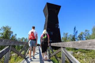
Observation Tower Saltkaret
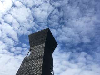
The impressive, tar coloured Saltkaret raises to over 20 meters height in the World heritage area of Kvarken Archipelago. The tower, located in the fish harbour Svedjehamn, offers a beautiful view over the De Geer-moraines. This unique moraine archipelago affirms the enormous power of the last ice age in the Kvarken Archipelago.
The visible area from the tower is a perfect example of the De Geer areas in Finland. The tower also pleases many bird-watchers, as many of the typical bird species of the island can be spotted in the area, such as black coots, terns and sea eagles. The wooden observation tower is also an excellent intermediate stopping point for hikers, because it is located directly by the hiking trail. You can reach the lower level of the tower also with prams or wheelchairs.
Driving directions to Saltkaret:
Saltkaret is located in Svedjehamn, which is in the municipality of Korsholm, about 40-45 minutes drive northwest from the centre of Vaasa. From Vaasa: drive on road number 742 (Alskatvägen/Alskatintie) north towards Replot (Raippaluoto) approximately 20 kilometres. After Replot continue straight on road 7240 (Replotvägen/Björkövägen OR Raippaluodontie/Björköntie) approximately 20 kilometres and you’ll arrive to Svedjehamn harbour where the road ends.
There is a free parking place in Svedjehamn. The observation tower can already be seen from the harbour and the parking place. Next to the parking place there is an information sign about the Björkö-Panike hiking trail. The observation tower is located by this trail; about 600 metres walk from the parking place.
You can find the map of the area and further information from excursion map.
-
Audio guide's episode 30. Björkö-Panike hiking trail, Saltkaret observation tower
-
Björkö-Panike hiking trails
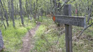
The archipelago section of the Björkö-Panike hiking trail
The archipelago section of the Björkö-Panike hiking trail is 8 km long and primarily traverses the island of Slåttskäret, right in the heart of the World Heritage site. Along the way, you’ll walk on uplifted shores shaped by post-glacial rebound, pass overgrown sea bays, cross narrow straits, and wander through birch groves used for summer grazing. The birch forests in the area are rich in windthrows and hollow trees, creating valuable habitats for a wide variety of plant and animal species. From June to October, sheep graze freely in the archipelago, helping to maintain the traditional landscape. The trail is equipped with lean-tos, designated camping areas, cooking shelters, and campfire sites.
A ferry operates from the Långgrund jetty to Stora Segelsören. Boat transport can also be arranged between Rotörskatan and either Vargis or Panike. Read more about the ferry and how to register as a driver.
The hiking trail is of moderate difficulty, and parts of the trail are rocky or damp.
Starting points:
1. Svedjehamn parking area: Björkövägen 1008, 65870 Björköby. The parking lot has a voluntary parking fee.
2. Vargis parking, Vargisvägen, 65970 Söderudden.The initial part of the trail
The initial part of the trail (Svedjehamn – Långgrundet – Svedjehamn) can be hiked without boat transport and partly as a loop. Depending on the chosen route, the hike can be approximately 7-10 km long.
Difficulty level: The trail is easy to hike, but there are stairs at two locations to cross sheep fences. The trail is partially rocky. The distance between Svedjehamn and the Märaryggen bridge’s observation platform (1 km/ direction) is a challenging accessible trail. No winter maintenance except on the path leading to the Saltkaret observation tower and a part of the parking lot.
Starting point: Svedjehamn parking area, Björkövägen 1008, 65870 Björköby. The parking lot has a voluntary parking fee.
Bodvattnet trail
Bodvattnet runt 4-km circle trail, with a demanding accessible section of 1 km or 1.4 km / each way
About 100 years ago, the old fishing port of Bodback set off on dangerous trips across the rocky Kvarken to Umeå. In addition to mail, government officials were also transported. Now only a small creek connects this port to the sea! Come and see how land uplift changes the Kvarken World Heritage landscape.
Difficulty: Demanding accessible.
Estimated travel time: During summertime the entire loop (4 km) on foot 1.5 hours, no winter maintenance.Travel time by wheelchair on one direction:
- The Svedjehamn parking area – Saltkaret observation tower – Märaryggen 1 km, approximately 0.5 hours.
- The Svedjehamn parking area – Bodback old harbour 1.4 km, less than one hour.
The trail between Svedjehamn parking area and Saltkaret observation tower is snow-cleared during wintertime, including the parking area.
https://www.luontoon.fi/en/trails/bjorko-panike-hiking-trail-korsholm-23858-en
-
Finland’s only Natural Heritage Site invites you for an adventure
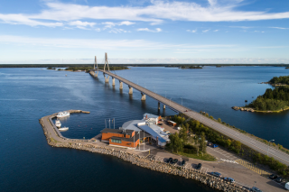
The unique Kvarken Archipelago is Finland’s only Natural Heritage Site on the international UNESCO World Heritage List.
-
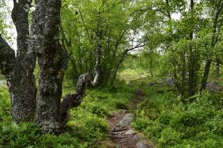
Bodvattnet runt 4 km circle trail, with a demanding accessible sections of 1 km and 1.4 km / each way
About 100 years ago, the old fishing port of Bodback set off on dangerous trips across the rocky Kvarken to Umeå. In addition to mail, government officials were also transported. Now only a small creek connects this port to the sea! Come and see how land uplift changes the Kvarken World Heritage landscape.
Difficulty: Demanding accessible.
Estimated travel time: During summertime the entire loop (4 km) on foot 1.5 hours, no winter maintenance.
Travel time by wheelchair on one direction:- The Svedjehamn parking area – Saltkaret observation tower – Märaryggbirdge 1 km, approximately 0.5 hours.
- The Svedjehamn parking area – Bodback old harbour 1.4 km, less than one hour.
The trail between Svedjehamn parking area and Saltkaret observation tower is snow-cleared during wintertime, including the parking area.
Starting point: The Svedjehamn fishing harbour parking area Address: Svedjehamn fishing harbour, 65870 Svedjehamn. The parking area does not have separate accessible parking spaces, but there is usually plenty of space. The parking area’s surface material is gravel. The parking area is flat.
https://www.luontoon.fi/en/trails/bodvattnet-trail-korsholm-62410-en
-
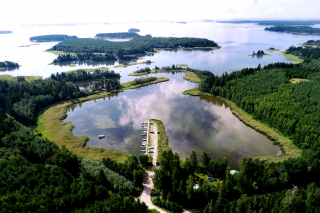
The gems of the archipelago
-
Korsholm is the number one destination for wellness tourists
Korsholm offers excellent conditions for wellness tourism.
-
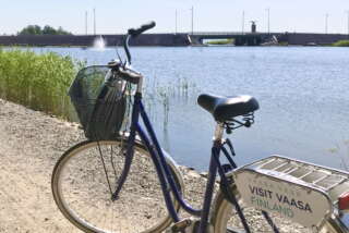
Cycle routes in the Vaasa Region
We present 12 suggestions for cycle routes you can choose from when you visit Vaasa. The length of the routes is from 5.3 kilometers to almost 100 kilometers.
-
Björkö Eagle´s nest cottages A (5-6 pers)
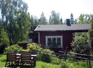
Welcome to the Eagles nest cottage(A)! We are located in BJÖRKÖBY, by
the harbour of SVEDJEHAMN, in the heart of the KVARKEN UNESCO world
heritage site. This unique area provides many opportunities to be with
nature. Fishing, paddling, 15 km of hiking, swimming and birdwatching.Cottage A is open all year round and accommodates 5-6 people or
families. This private cottage has its own parking, entrance and lobby.
It has a large garden with furniture/barbeque/games and own path (60m)
to the sea. A bedroom, living room, bathroom, fully-functional
kitchenette, fireplace. Wood-burning sauna available by booking on
arrival and even MASSAGE treatments by appointment. FULL cottage &
services info & photos on booking page. Pets are also welcome!Why not go by CANOE! We rent 3 person Canadian canoes for
paddling/fishing. Steady and safe in the water. When the weather is nice
there is no better way to spot an eagle and DISCOVER THE MORAINES! Book here: https://eaglesnestcanoes.simplybook.it/v2/ or when you arrive. A
boat with 6HP motor also available to rent.Locally; Shop/Cafe BJÖRKÖ HANDELN has all you need and you can visit
MÅRTES MUSEUM and BJÖRKÖ church also in the village. In the harbour
visit the idyllic Restaurant/Cafe SALTERIET, KVARKEN SHOP souvenir
shop, INFO point and BJÖRKÖ BOAT MUSEUM. From the harbour take BODBACK
RUNT nature trail(3.4Km) and climb the SALTKARET observation tower for
the views. Finally, experience the BJÖRKÖ-PANIKE HIKING TRAIL(11.6Km,
check ferry times, map and info on our website) which begins or ends
here!+358 50 536 8275
info@bjorkonkotkanpesa.com
-
Björkö Eagle´s nest cottages B (2-4 pers.)
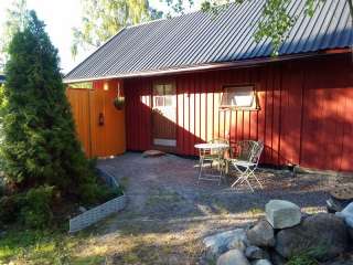
Welcome to the Eagles nest cottage(B)! We are located in BJÖRKÖBY, by the harbour of SVEDJEHAMN, in the heart of the KVARKEN UNESCO world heritage site. This unique area provides many opportunities to be with nature. Fishing, paddling, 15 km of hiking, swimming and birdwatching.
Cottage B is open all year round and accommodates 2-4 people or families. This private cottage has its own parking, entrance and a charming garden with furniture/barbeque/games and own path only 60m to the sea! Inside, you will find a living room with double sofa-bed and single bed, a loft(double and single mattress) a bathroom with shower and a fully-functional kitchenette. Wood-burning sauna available by booking on arrival and even MASSAGE treatments by appointment. FULL cottage & services info & photos on booking page. Pets are also welcome!
Why not go by CANOE! We rent 3 person Canadian canoes for paddling/fishing. Steady and safe in the water. When the weather is nice there is no better way to spot an eagle and DISCOVER THE MORAINES! Book here; https://eaglesnestcanoes.simplybook.it/v2/ or when you arrive. A boat with 6HP motor also available to rent.
Locally; Shop/Cafe BJÖRKÖ HANDLEN has all you need and you can visit MÅRTES MUSEUM and BJÖRKÖ church also in the village. In the harbour visit the idyllic Restaurant/Cafe SALTERIET, KVARKEN SHOP souvenir shop, INFO point and BJÖRKÖ BOAT MUSEUM. From the harbour take BODBACK RUNT nature trail(3.4Km) and climb the SALTKARET observation tower for the views. Finally, experience the BJÖRKÖ-PANIKE HIKING TRAIL(11.6Km, check ferry times, map and info on our website) which begins or ends here!
+358 50 536 8275
info@bjorkonkotkanpesa.com
-
To see in the Kvarken
Cross the Kvarken Archipelago off your bucket list!
-
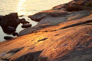
Traces of the Ice Age
-
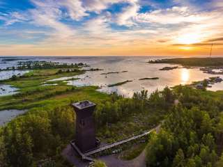
World Heritage from above
The unique Kvarken Archipelago is Finland's only Natural World Heritage Site on the UNESCO World Heritage List. Together with Sweden's High Coast, the Kvarken Archipelago is the best place in the world to experience and understand the land uplift phenomenon caused by the last Ice Age.
-
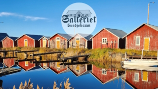
When you drive over the Replot bridge and continue as far as the road ends, you will reach Café Salteriet Svedjehamn in the atmospheric harbor of Björköby. The maritime location in the middle of a stunning UNESCO World Heritage Site offers unforgettable experiences to all travelers. Welcome to experience the atmosphere of the old fish harbor cafe and enjoy fresh baked goods and delicious dishes from our kitchen, which you can also take with you to enjoy nature!
Björköby’s nature and Café Salteriet Svedjehamn is a wonderful destination for travelers of all ages. We can also serve larger groups.
On top if the beautiful scenery, close by there are hiking trails as well as the observation tower Saltkaret.
+358 44 239 8821
info@salterietsvedjehamn.fi
-

One of the Kvarken’s specialties is definitely the De Geer moraines, or washboard moraines, that form clear streaks in the scenery. You can see these formations best from the observation tower Saltkaret or along the Bodvattnet nature trail.
Is it difficult to choose which place to visit in the Kvarken? Here is some tips of the archipelago’s gems for you!
-
Inspiration From the Nature
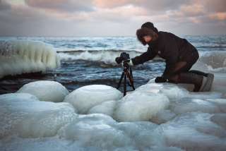
Nature around the Vaasa region provides photographer Christoffer Björklund with inexhaustible source of subjects and inspiration for practicing his profession.
-
Kvarken Audio Guide
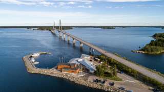
This audio guide presents five places in and close to the Kvarken Archipelago World Heritage site.
-
The best sunset spots in the Vaasa Region
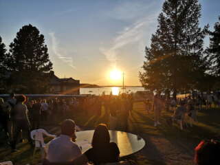
Admire the sun set in the sea while enjoying the fresh air of the summer evening: we have listed the best sunset spots in the Vaasa region.
-
Finland’s only Natural Heritage Site invites you to a a landscape shaped by sea and ice
The unique Kvarken Archipelago is Finland’s only Natural Heritage Site on the international UNESCO World Heritage List.
-
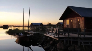
Idyllic fisherman’s cottage by the sea for 1-4 people. Own wood-heated sauna and a large terrace where you can take a dip in the sea. The nature trails start right behind the cottage and it is about 400m to the Saltkaret observation tower. There is no running water or electricity in the cabin, but here you can enjoy authentic, simple camping and peace. Camping season May-September.
+358 44 271 1522
svedjehamncamping@visitbjorko.fi
