
Activities and Nature
Search for interesting activities by type and / or area or with the help of keywords, end by pressing "Show results"
26 Search results, page 1/2
Clear filters-
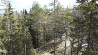
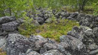
Andkil hiking trail consists of two stretches, one of 1.7 km and a longer round of almost 9 km.
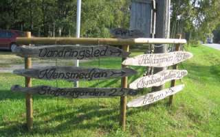
Signs to the trail from Rejpeltvägen / Torrkullvägen and on towards Kondivorvägen.
The first part of the longer stretch, consists of rising terrain, partly over boulders and rocks. Then you continue through forest, land and open landscapes. The highest point of the trail is 52 meters above sea level. Along the latter part of the trail there are places marked with signs, where the names of the places are written in dialect. The name of the places has come from old legends. Let your imagination live and invent the story behind the names of the places.
https://www.vora.fi/tjanster/motion-och-idrott/vandringsleder/
-
Start: Haviståkersvägen 95, Vörå. The paths start behind the outbuilding at Arvidsgården.
Distance: Arvidsstigen 1.3 km, Vernersstigen 1.5 kmSuitable for everyone. Also available with pram. During the summer, there are fairy tale characters and toy animals along the paths.
https://www.vora.fi/tjanster/motion-och-idrott/vandringsleder/
-
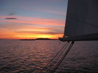
The name ”Solrutten” translates to The Sunny Route in English. The concept was originally formed in the 1970’s. The operators who developed The Gulf of Bothnia’s sea lane network at that time came up with the name. Today the Sunny Coast Route stretches through 13 municipalities and towns’ sea areas along the west coast of Finland, from Kristiinankapunki in the south to Kokkola in the north.
The routes and marinas are geographically featured according to in which municipality they are situated. As the municipalities and the regional council mediate a lot of information to travelers, we have on our part decided to create our own website based on the municipality division. In this way sailors can easily access information about the municipality they are passing through and thus making information search a lot easier.
The archipelago of Ostrobothnia is shallow and stony. This means that navigation in the region requires a great deal of skill and care. We have decided to create the information about routes and the information given about how to approach the marinas on a basis requested by those skippers who navigate with deeper boats.
On the web page solrutten.fi you find route suggestions and recommended destinations. On the map, you can click on a selected location for more information about the harbor and how to approach it.
-
-
Start from Brännarsvägen 730.
Routs: 1.7 km, 3.5 km and about 6 km.Along the trail a small barbecue place and a bench for resting.
https://www.vora.fi/tjanster/motion-och-idrott/vandringsleder/
-
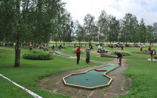
Disc golf Courses in the Vaasa Region
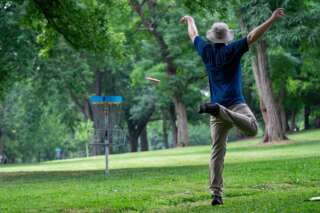
The Frisbee golf courses in the Vaasa region offer games in fantastic surroundings and varied terrain.
-
The trail 3,6 kilometers long trail starts from Tottesund Manor and goes through the Manor Park, from there it takes a turn to Bytesholmsudden and returns to the Manor. The terrain varies from a and easily walked dirt road to small trails.
https://www.vora.fi/tjanster/motion-och-idrott/vandringsleder/
-
INGSVA
-
Fisheries Management Fee
The fisheries management fee is required if you are 18–69 years of age and will be fishing with lures or traps or crayfishing.
The fisheries management fee entitles you to fish in nearly the entire country using one rod. In some cases, however, anglers will require the permission of the owner of a given water area. Proceeds from the fisheries management fee are used to manage fishing waters and fish stocks as well as monitor fishing activity and provide advice to anglers.
https://www.eraluvat.fi/en/fishing/fisheries-management-fee.html
-
Start from Kimo Bruk, Bruksgatan 38.
Parking is available up by the road. The trails are 1.5 km, 3 km, and 8 km.
Four rest areas with tables and benches are provided. The 1.5 km and 3 km trails are wide gravel paths suitable for strollers and, with assistance, wheelchairs, depending on the weather and season. The 8 km route includes partly uneven terrain.
Here you can find more information, a printable map, and an interactive map where you can explore the trail online.
Maps and a more detailed brochure are available for purchase at Kimo Bruk Museum and Gallery, as well as at Einar’s Café:
Conclude your hike with a leisurely stroll through the beautiful industrial park and take a lap around the “virgin dance” or stone labyrinth at the bruk (ironworks).
https://www.vora.fi/tjanster/motion-och-idrott/vandringsleder/
-
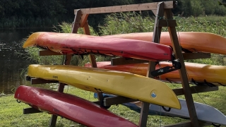
KAJAK RENTAL
Kvarken4seasons offers kayak rentals on Västerö in Maxmo archipelago. Rent a kayak for a few hours, a full day or even longer. We are also mobile and can deliver the kayaks to your preferred starting point in the Maxmo archipelago. Contact us to learn more.
Kvarken4seasons offers a sauna experience in a beautiful natural setting. Unwind in a traditional sauna by the shoreline. Small and simple, surrounded by the peacefulness of nature.+358 45 883 2209
kvarken4seasons@gmail.com
-
Signs from Lotlaxvägen, Vörå. Längd: 3, 5 km.
Halvvägs finns en rastplats med bordsgrupper.The hiking trail of about 3.5 kilometers was laid out in the late 1980s by Lars Hannus and restored by the local community association in the summer of 2014. About halfway there is a rest area with table groups where you can pause and enjoy the tranquility.
https://www.vora.fi/tjanster/motion-och-idrott/vandringsleder/
-
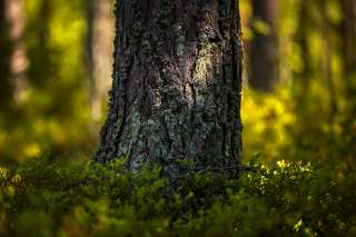
Mickelsörarna Nature Trail on Kummelskär Island is about 2 km long. The thematic trail starts from the yard of the nature information station. At first, the trail runs 200 metres along a back-and-forth trail, after which the circle trail section begins. It is possible to take a detour to the seashore halfway through the circle trail to admire the scenery. You will have to walk a total of 500 extra metres if you choose to take the detour. Then, you will return to the circle trail section. Once you have travelled the entire circle trail, you will return to the trail that takes you back to the starting point.
Along this nature trail, visitors are able to see the geology, vegetation and animals of the land uplift shores, foundations of old fishing huts and boat docks from the 16th century. Please note that the trail can only be accessed by water.
There is a lean-to shelter, a campfire site and a dry toilet as well as a rental sauna in the harbour at the starting point. You can climb the observation tower in the summer, when the nature information hut is open. A summer café operates in connection with the nature information station.
https://www.luontoon.fi/en/trails/mickelsorarna-nature-trail-voyri-63857-en
-
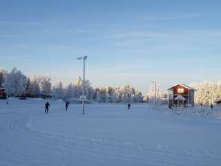
Norrvalla is a versatile sports and activity centre located in the heart of the Vaasa region – a place where exercise, meetings and memorable experiences come together in an inspiring setting. It offers excellent opportunities for everything from training camps and activity days to conferences and group events for both small and large groups.
The area features modern facilities for a wide range of activities. Visitors can enjoy a full-size sports hall, indoor and outdoor gyms, a swimming pool, an obstacle course, as well as mini golf and disc golf courses. Football players benefit from both an artificial turf field and an indoor football hall, making it possible to train all year round.
Surrounded by beautiful nature, Hotel Norrvalla offers scenic fitness trails and a peaceful atmosphere – perfect for both active days and relaxing moments outdoors.
For meetings and events, several well-equipped venues are available. The main building features an auditorium with seating for up to 150 people, while Holmsgården provides a unique and atmospheric historical setting for gatherings. All meeting rooms are equipped with modern technology.
Meals are served at Elsas Kök, where the focus is on high-quality ingredients and locally sourced produce whenever possible. The restaurant serves lunch every day of the week, and Elsas Café offers coffee, pastries and other café treats for visitors and guests.
Throughout the year, a variety of indoor and outdoor activities and programmes are organised. This makes Norrvalla a popular destination for staff days, celebrations, training camps and other shared experiences.
+358 6 383 1012
norrvalla.reception@folkhalsan.fi
https://www.folkhalsan.fi/en/vara-verksamhetsplatser/norrvalla
-
Rent mini-golf equipment from the reception at Hotel Norrvalla.
+358 44 383 1000
norrvallaminigolf@gmail.com
-
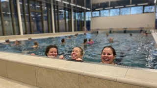
Norrvalla Swimming Pool is located at Campus Norrvalla. The facility features two pools: one for adults and one for children. The main pool has four lanes and is 16.6 meters long, meaning that three full laps back and forth add up to 100 meters. This pool is ideal for swim training and exercise.
The children’s pool is designed to be safe and fun for the youngest visitors.
For those who enjoy a colder dip, there is also a cold pool.
Adjacent to the swimming hall, you will find Norrvalla Gym.
https://www.vora.fi/tjanster/motion-och-idrott/norrvalla-simhall/
-
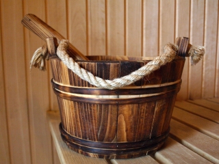
Sauna for groups on request.
Food and program can also be ordered.
+358(0)50 300 1037
lilianpetterssonsmeds1808@gmail.com
-
Signs from Norrvalla, Vöråvägen 305-307.
Routes from 3 km to 7 km.The connecting route between Bobergsleden and Vitmossleden provides the opportunity for long trips as the distance is over 20 km round trip. Shorter stages can also be hiked along the trail as it passes several slip roads along the forest road in Rökiö where you can start.
You experience varied nature in the form of boulders, old magic forest, bogs and swamps as well as ancient relics.Karta Norrvalla-Boberget
Karta Norrvalla-Boberget-Lasor-Vitmossenhttps://www.vora.fi/tjanster/motion-och-idrott/vandringsleder/
-
-
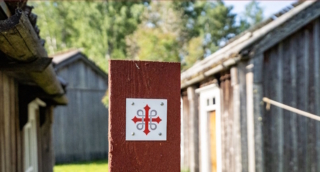
A European pilgrimage route through coastal Ostrobothnia. Connects up with the Norwegian-Swedish route St. Olavsleden, which leads to Trondheim. A total of 500 km long when complete.