
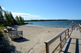
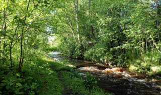
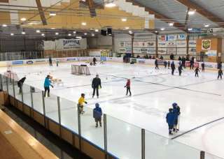
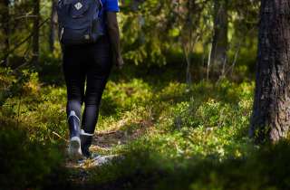
Activities and Nature
Search for interesting activities by type and / or area or with the help of keywords, end by pressing "Show results"
22 Search results, page 1/2
Clear filters-
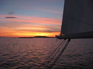
The name ”Solrutten” translates to The Sunny Route in English. The concept was originally formed in the 1970’s. The operators who developed The Gulf of Bothnia’s sea lane network at that time came up with the name. Today the Sunny Coast Route stretches through 13 municipalities and towns’ sea areas along the west coast of Finland, from Kristiinankapunki in the south to Kokkola in the north.
The routes and marinas are geographically featured according to in which municipality they are situated. As the municipalities and the regional council mediate a lot of information to travelers, we have on our part decided to create our own website based on the municipality division. In this way sailors can easily access information about the municipality they are passing through and thus making information search a lot easier.
The archipelago of Ostrobothnia is shallow and stony. This means that navigation in the region requires a great deal of skill and care. We have decided to create the information about routes and the information given about how to approach the marinas on a basis requested by those skippers who navigate with deeper boats.
On the web page solrutten.fi you find route suggestions and recommended destinations. On the map, you can click on a selected location for more information about the harbor and how to approach it.
-
-
Erklasstigen nature trail in Pörtom 2 km turn and return. Start from the graveyard in Pörtom village.
Coordinates; ETRS-TM35FIN N: 6964124 E: 224240
-
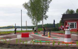
You find the mini-golf course next to Restaurant Sea Side. Why not play a mini-golf tournament first and after that visit the restaurant for a meal.
+358 6 225 2666
info@fagero.fi
-
Disc golf Courses in the Vaasa Region
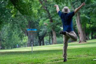
The Frisbee golf courses in the Vaasa region offer games in fantastic surroundings and varied terrain.
-
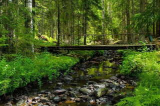
Fållbäckstigen on Högåsen in Övermark runs through the forest south of Högåsen. It is a 6.5 km long path that goes through varying terrain and is marked with yellow marks.
Start from Högåsen’s sports cabin, coordinates ETRS-TM35FIN N: 6951949 E: 219851
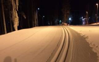
In winter there is a ski trail here.
-
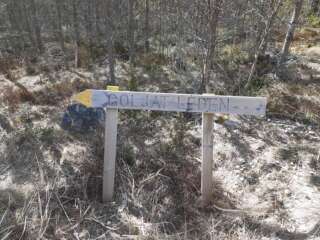
Goljatlelden is about 18 km long and marked in the terrain with signs and yellow markings. Goljatleden starts at the corner of the biathlon arena at Vargberget’s leisure center. The trail goes from Vargberget to the forest around Svartbäck and there you also find rest cabins.
Coordinates ETRS-TM35FIN N: 6942607 E: 215212
-
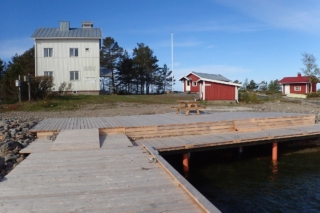
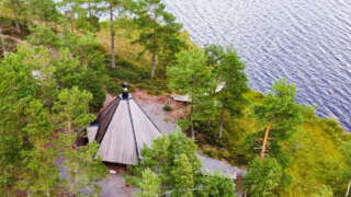
The Gåshällan Nature Station is a renovated former coast guard station located on a rocky island far out in the Närpes archipelago. The nature station is now owned by the Forest Administration and leased by Solrutten.
The island, with its rugged but vibrant outer archipelago nature and its rich plant and bird life, is a place that easily captures your heart.
The unique nature is very sensitive to wear and tear. For many years, birds and humans have been able to live in harmony with each other on Gåshällan, and this should naturally continue. The rich breeding bird fauna limits freedom of movement on the island during the breeding season from May 1 to July 15.
On the northern part of the same island, there is a former pilot station, which today serves as a support point for boaters.
The nature station is suitable for boaters, school camps, companies, private individuals, bird watchers, courses, and other types of groups. We recommend day groups of up to 20-25 people and overnight groups of up to about 15 people, for convenience.
-
-
INGSVA
-
Fisheries Management Fee

The fisheries management fee is required if you are 18–69 years of age and will be fishing with lures or traps or crayfishing.
The fisheries management fee entitles you to fish in nearly the entire country using one rod. In some cases, however, anglers will require the permission of the owner of a given water area. Proceeds from the fisheries management fee are used to manage fishing waters and fish stocks as well as monitor fishing activity and provide advice to anglers.
https://www.eraluvat.fi/en/fishing/fisheries-management-fee.html
-
-
-
Raineåsen’s nature trail to Storstenrösback ancient graves is about 1.5 km round trip. Start from parking area close to the hunting lodge at Raineås forest road in Pörtom, coordinates ETRS-TM35FIN N: 6969807 E: 220857
-
Risnästräskstigen in Övermark, 0.9 km to the barbecue hut at Risnästräsket and 2.1 km around the swamp.
Start from the parking spot at Heide forest road, coordinates ETRS-TM35FIN N: 6963477 E: 214123
-
-
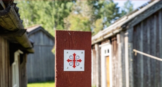
A European pilgrimage route through coastal Ostrobothnia. Connects up with the Norwegian-Swedish route St. Olavsleden, which leads to Trondheim. A total of 500 km long when complete.
-
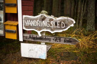
Tjärlax nature trail 4.1 km or a shorter stretch of 1.7 km. Start from Tjärlax holiday village.
Start coordinates ETRS-TM35FIN N: 6936714 E: 201995
Along the hiking trail you encounter nature that is unusual for these areas. The oldest tree in Närpes is also found here.
-
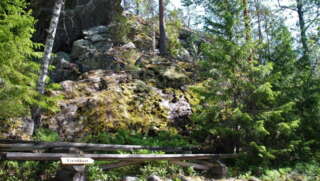
The trail is about 3 km long. Along the trail there is a lot to see, including a cave, devil’s fields and ancient monuments. At the barbecue area there is also a lookout point where you can enjoy views of Övermark. The trail starts at the Övermark hembygdsgård, but you can also start where the path itself begins at Bergsvägen 34. There is a box with maps at both places, but there are better parking options at Hembygdsgården.
Coordinates for Hembygdsgården: ETRS-TM35FIN N: 6955016 E: 223288
-
Velkmossa hiking trail starts on the other side of the road from Velkmoss byagård, Ribackvägen 94 or from Viitala in Petalax. The trail is 9 km long round trip.
The trail is marked with yellow ribbons and yellow paint on trees, along with informational signs. Along the hiking trail, you’ll encounter Nojärv Swamp, where a bird observation tower is located. Nojärv Swamp is a marshy and overgrown wilderness lake, providing a favorable nesting environment for many bird species. Along the hiking trail, there is also a path leading to Kackur Bog as well as ancient graves and old settlements.
Coordinates ETRS-TM35FIN N: 6971020 E: 215932: 215932