Activities and Nature
Search for interesting activities by type and / or area or with the help of keywords, end by pressing "Show results"
14 Search results, page 1/1
Clear filters-
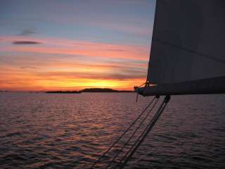
The name ”Solrutten” translates to The Sunny Route in English. The concept was originally formed in the 1970’s. The operators who developed The Gulf of Bothnia’s sea lane network at that time came up with the name. Today the Sunny Coast Route stretches through 13 municipalities and towns’ sea areas along the west coast of Finland, from Kristiinankapunki in the south to Kokkola in the north.
The routes and marinas are geographically featured according to in which municipality they are situated. As the municipalities and the regional council mediate a lot of information to travelers, we have on our part decided to create our own website based on the municipality division. In this way sailors can easily access information about the municipality they are passing through and thus making information search a lot easier.
The archipelago of Ostrobothnia is shallow and stony. This means that navigation in the region requires a great deal of skill and care. We have decided to create the information about routes and the information given about how to approach the marinas on a basis requested by those skippers who navigate with deeper boats.
On the web page solrutten.fi you find route suggestions and recommended destinations. On the map, you can click on a selected location for more information about the harbor and how to approach it.
-
-
Disc golf Courses in the Vaasa Region
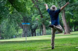
The Frisbee golf courses in the Vaasa region offer games in fantastic surroundings and varied terrain.
-
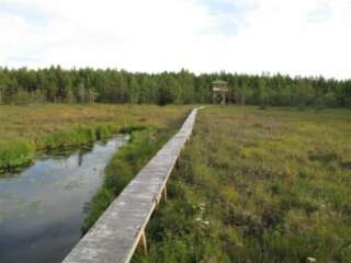
Hamnsträskets hiking trail is located on Södra Björkö in Harrström. The swamp has a rich bird life and in the scenic area by the swamp there is a large lookout tower.
The trail is about 2 km long and there is a barbecue area by the swamp.
More information on www.harrstrom.fi
https://www.korsnas.fi/bibliotek-kultur-fritid/vandringsleder/
-
INGSVA
-
Fisheries Management Fee

The fisheries management fee is required if you are 18–69 years of age and will be fishing with lures or traps or crayfishing.
The fisheries management fee entitles you to fish in nearly the entire country using one rod. In some cases, however, anglers will require the permission of the owner of a given water area. Proceeds from the fisheries management fee are used to manage fishing waters and fish stocks as well as monitor fishing activity and provide advice to anglers.
https://www.eraluvat.fi/en/fishing/fisheries-management-fee.html
-
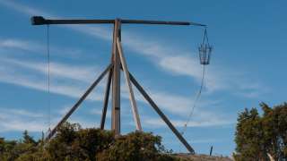
Molpehällorna Nature Trail is about 2 km long and starts from the yard of the Molpe Nature station. The trail is a circular route, with a spur leading to the Molpehällorna beacon. The circular part of the route is one kilometer long, and visiting the beacon adds another kilometer.
Along the nature trail you’ll see the geology, vegetation and animals of the land uplift shores as well as a reconstruction of the Molpehällorna “vippbåk” beacon (which is a memorial for the first beacon in the Gulf of Bothnia).
The trail is available only by boat.
https://www.luontoon.fi/en/trails/molpehallorna-nature-trail-korsnas-35566-en
-
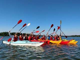
Polkuped kayak offers guided tours and rental of kayaks. We are located in Molpe on the west coast of Finland, about 30 minutes south of Vaasa. Molpe is a true paradise for those who love the sea, to practice various sport activities, to swim or just enjoy the nice nature. Welcome!
+358 50 536 6281
info@polkuped.fi
-
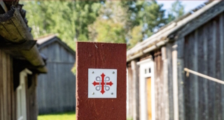
A European pilgrimage route through coastal Ostrobothnia. Connects up with the Norwegian-Swedish route St. Olavsleden, which leads to Trondheim. A total of 500 km long when complete.
-
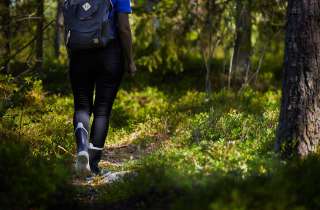
The Waterloo trail starts at the Waterloo jogging track which is located along Strandvägen between Korsnäs and Molpe (Strandvägen 3681).
The trail runs between the Waterloo area and Lisasgrynnan by the sea shore. Beautiful hiking trail with many different terrain types to hike through. A geocache is also located at one of the rest areas.
The trail is about 7.3 km (3.66 km in one direction).In the same area you will also find a Disc Golf Park, fitness stairs and a playing area for boules.
https://www.korsnas.fi/bibliotek-kultur-fritid/vandringsleder/
-
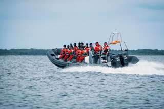
Tailor-made packages for companies and groups.
We offer complete solutions that are adapted to your wishes. Our packages can include various activities and services to ensure a memorable experience!
+358 (0) 50 367 2037
westcoastribcharter@gmail.com
-
Westcoast Sportfishing
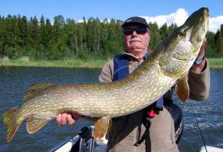
Experience a great fishing adventure in the Kvarken Archipelago with Westcoast Sportfishing and fishing guide Johan Nydahl. I guide You or Your company all year around with different rod fishing techniques after perch and pike.
To guide larger groups I co-operate with other fishing guides in the area. Arranging half and whole day fishing experience, excluding or including lunch, sauna and dinner depending on your requirements.
+358 40 1627674
johan@westcoastsportfishing.fi
-
YourCoach
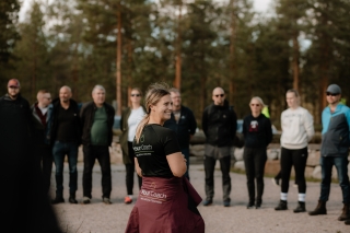
YourCoach is a leading player in wellness and well-being at work in Ostrobothnia. We offer a wide range of services for companies, organisations and groups. Our tailor-made TYKY and TYHY days aim to promote staff health and well-being through inspiring and fun activities and programmes that can be fully adapted to the needs of the group. We also offer fully customised solutions. Our programme concepts and services are also ideal for Christmas parties, staff days, birthdays and more.
We offer both inside and outside activities and programmes that are suitable for any season.
Through us you can book everything from programmes, food to facilities.
+358 50 386 4481
anna@yourcoach.fi
-
Desitnations and trails in the service Luontoon
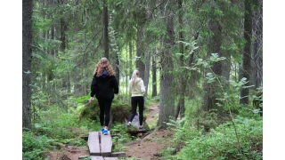
You can find information on all outdoor recreation destinations, trails and services throughout Finland on the Luontoon service.
